Google Maps shortest distance: 4.1 m
Distance run: 4.84 m
Let me ask you a question: When was the last time you smiled just to yourself? Not when reading a book or a blog, not when surrounded by your friends, not when watching a sitcom (preferably the kind without a laugh track), but just by yourself, doing something that you love.
I did that this morning. I was running down the street like a complete idiot grinning from ear to ear. I saw some of the coolest things I've seen in this city yet; things I didn't even know were IN this city. AND I took all the photos with my handy-dandy new
WATERPROOF Kodak Playsport camera/camcorder (which also has a wrist strap, handy for when you slip and fall on ice. Not that I EVER did that on Feb 4, 2011 at approx. 7:45 am). In case you can't tell, I'm excited. To start, the route, after the jump:
It's another ridiculous route...partly for sightseeing purposes and partly because I wasn't sure where to go from the Metro and there were a lot of surly looking people on their way to work and I didn't want to look stupid...
 |
| Horribly unrepresentative photo of a street in Fort Totten |
I also didn't take a photo (because of the aforementioned self-consciousness) of the first thing I noticed about the Fort Totten Metro...condos. Apparently they have built up a lot of new condos and apartment buildings up there in the past few years. Some of them seem really nice. Fort Totten as an area isn't like NE DC in the way that I think a lot of NW DCers view NE. It's sort of suburban...not really a nightlife, a LOT of houses, churches, parks and schools. The houses are a mixture of rowhouses, duplexes, and free-standing homes. They seem to have largely been built in the immediate post-war era, but I'm no architecture expert so that could be up for debate... Either way, it's quite nice.
The houses have a comforting, lived-in quality, like the people living there have been living there for years, and other than in apartment complexes, I rarely saw a "For Rent" sign (unlike some neighborhoods in DC frequently populated by college students or 20-something apartment-hoppers...like me).

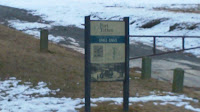
One thing that Fort Totten had, and something that has made me wary of going on these runs in unfamiliar neighborhoods while it's still sub-freezing, was ice. Lots of it. Hence the aforementioned slipping on ice. Ignoring this mild inconvenience, I traveled south along Rock Creek Church Rd NE, which turned into the aptly named Fort Totten St. Somewhere along the way I passed something that on Google Maps was labeled Mamie D Lee Before & After. It wasn't until I ran past it that I realized it was Before & After SCHOOL. I don't have kids so maybe that's why I don't think of these things... Eventually, I reached the even MORE aptly named Fort Totten Park. Although Fort Totten makes many people think of the well-known former military establishment in
Queens, we actually had a
Fort Totten in DC during the Civil War. It was an advance in between Maryland and the Soldiers' Home, which was where Abraham Lincoln spent his summers (more on that later...). There aren't any actual structures there anymore, but you can see the ramparts (the earthen walls built around the fort).

At some point after Fort Totten I turned on Allison St. and passed Hawaii Ave...if only it felt like ACTUAL Hawaii at that intersection, rather than the 24 degrees it actually was...
I ran west on Allison for a while, looking at some more houses and general scenery, until suddenly I was surrounded on all sides by death. I had known cemeteries were coming, and I had seen what looked like military headstones about a block ahead of me, but when I had a cemetery on either side, it was pretty breathtaking.
 |
| On one side, Rock Creek Cemetery |
 |
| On the other, the Soldiers' Home National Cemetery |
 |
| Mausoleums |
Honestly, I didn't know either one of these things was here until I started doing research for this run. I'll start with
Rock Creek Cemetery. It's old...started in the early 1700s as a cemetery/public park (Can you imagine if someone proposed that now? "Yes, we'd like to use this empty land to bury dead people...and also for picnics and frolicking.") There are several notable mausoleums in the cemetery, probably the most notable the Adams Memorial, adorned with Augustus Saint-Gaudens' statue "The Mystery of the Hereafter and The Peace of God that Passeth Understanding," colloquially known as "
Grief." It's a famous piece of American sculpture and is listed on the National Register of Historic Places.
 |
| Photo of far-off grave markers |
 |
| Front gate of the Soldiers' Home Cemetery |
So, the Soldiers' Home National Cemetery is more formally the
United States Soldiers' and Airmen's Home National Cemetery. As the name implies, the cemetery is next to the Soldiers' Home (
Armed Forces Retirement Home), which is a retirement home for military veterans. There are only two national cemeteries administered by the Department of the Army...this one and Arlington National Cemetery (although there are around 150 national cemeteries nationwide).
 |
I didn't go IN the gates...they were checking IDs and I didn't
have one...but I'll definitely be going back for a to |
What's most exciting about the Soldiers' Home (to me) is that several presidents - including Buchanan, Lincoln, Hayes and Arthur - used to live there during the summer months (at the time, this area was about three miles from the city center, so it was considered an escape to higher ground from the heat/humidity as well as the politics). There is a cottage on the property that has long been known as President
Lincoln's Cottage. He is believed to have drafted the Emancipation Proclamation there (at least in part) during the summer of 1862.
When I got past the Soldiers' Home, I headed on Illinois Ave (so many states today!) toward Grant Circle Park, where I expected to find something a little more exciting than I found. It was just a basic traffic circle with grass and benches. But it was surrounded by some pretty cool churches (which DC seems to be full of...someone should write a book about all the churches). The first I saw was the Petworth United Methodist Church. I couldn't find any information about the building online, so I might have to check it out in person and see what's up...it's remarkable looking from the outside.
 |
| Petworth United Methodist Church |
The second is St. Gabriel's Rectory, which is a Catholic Church. Also not a lot of information online other than mass times, etc, but here's a photo:
 |
| St. Gabriel's Rectory |
From the circle, I crossed Georgia Avenue at like a states' convention or something...Georgia Ave, Iowa Ave, and Kansas Ave are all within a block of each other and/or intersecting each other.
 |
| Culture clash |
 |
| My home state |
On Upshur St I ran past Roosevelt High School, which has a pretty awesome looking football field. I also enjoy that they are called the
Rough Riders, like ole' Teddy's men. Although I do wonder how many of the high school students (and for that matter citizens of the city) get that reference...
Near Roosevelt, I saw another school that I'd only read about before.
Hospitality High School is a
public charter school that was started by the Hotel Association of Washington, DC and other groups. The goal is to prepare the students for college success as well as success within the hospitality industry. It's a pretty innovative approach to education; the students have to complete coursework in hospitality as well as internships in local hotels, etc.
Eventually I turned on my final state street of the day, Arkansas Ave. In the vicinity I also saw some awesome yard art.

Here's where things started to get hairy. Google Maps told me to turn left and go south on Piney Branch Parkway. That would be fine if I were in a car, but clearly I wasn't. Piney Branch Pkwy has no sidewalk...it's a thruway for folks who want to get through the Park. I looked down the hill at the lack of sidewalk and thought maybe I would find another way to go. I ran down 16th St, then stood on the bridge OVER Piney Branch. (See graffiti on really cool bridge:)
 |
| :( <---sad face |

From up there I could see that many a cyclist/runner/vagrant had tramped a trail through the grass beside the Parkway. So I doubled back, figuring if they could do it I could, too. I got an awesome view of the bridge from underneath (it's apparently called the Piney Branch Parkway Bridge...clever). You can probably already tell in this photo what I ran into...
Ice. It looks like snow, but it seems like the top layer has been melting in the daytime and refreezing overnight, so it's mostly ice or very hard snow. Awesome. I pretty much walked/shuffled the last 1.5 miles or whatever it was home from here. It wasn't too exciting from here on out...some Rock Creek Park views, a lot of cars stuck in rush hour traffic (when I was running on Piney Branch, I was running faster than the cars were moving), a turn onto Beach Drive and then a turn onto Porter St to come up that stupid, godforsaken hill to Connecticut. I'll leave you with the last bit of my journey, in pictures...
 |
| WTF is this? |
 |
| Rock Creek Park picnic area 29...with lonely melting snowman |
 |
| This used to be a usable sidewalk |
 |
The ice parts, and a
sidewalk appears out of gravel... |
 |
Probably fun to slide down,
not so much to walk up |


 One thing that Fort Totten had, and something that has made me wary of going on these runs in unfamiliar neighborhoods while it's still sub-freezing, was ice. Lots of it. Hence the aforementioned slipping on ice. Ignoring this mild inconvenience, I traveled south along Rock Creek Church Rd NE, which turned into the aptly named Fort Totten St. Somewhere along the way I passed something that on Google Maps was labeled Mamie D Lee Before & After. It wasn't until I ran past it that I realized it was Before & After SCHOOL. I don't have kids so maybe that's why I don't think of these things... Eventually, I reached the even MORE aptly named Fort Totten Park. Although Fort Totten makes many people think of the well-known former military establishment in Queens, we actually had a Fort Totten in DC during the Civil War. It was an advance in between Maryland and the Soldiers' Home, which was where Abraham Lincoln spent his summers (more on that later...). There aren't any actual structures there anymore, but you can see the ramparts (the earthen walls built around the fort).


 From up there I could see that many a cyclist/runner/vagrant had tramped a trail through the grass beside the Parkway. So I doubled back, figuring if they could do it I could, too. I got an awesome view of the bridge from underneath (it's apparently called the Piney Branch Parkway Bridge...clever). You can probably already tell in this photo what I ran into...


No comments:
Post a Comment